
Route-aware terrain
The selected area follows the route instead of forcing the trail into a generic square terrain crop.
GPX trail models
TopoPrint 3D combines a hiking route with real elevation data and a print-sized terrain footprint. Use it for completed hikes, mountain tours, travel memories and personalized route gifts.
From recorded hike to physical model
A normal map export starts with a place. TopoPrint starts with the route. After a GPX import, the trail defines the useful map area and the model scale adapts to the selected printed size.
The result combines terrain relief, a raised route and optional map layers in one print-ready project. Captions can include distance, duration and elevation gain without requiring a separate 3D design tool.
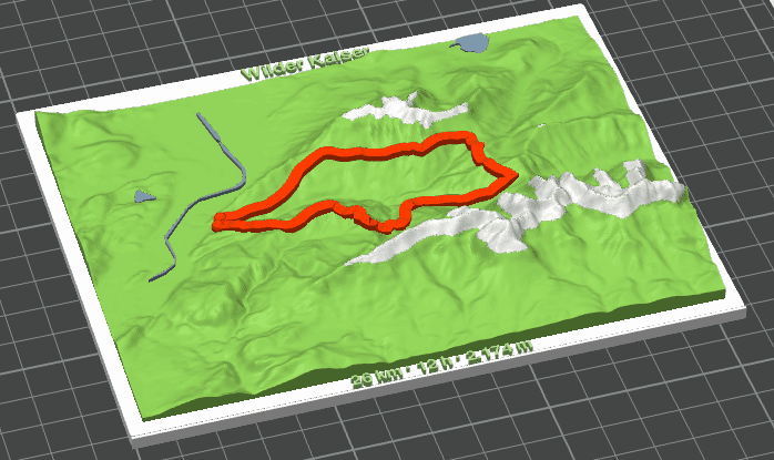
The selected area follows the route instead of forcing the trail into a generic square terrain crop.
Distance, duration and elevation gain are calculated automatically and can be replaced with your own values.
Route, terrain, snow, water and captions remain separate named parts for easier filament assignment in a slicer.
Upload a GPX track or create a route between places. The map moves to the trail area automatically.
Choose the model shape and printed max edge, then adjust the footprint directly on the map.
Adjust relief, route width, snow, colors and caption values before downloading the multi-part 3MF file.
The printed max edge and selected geographic footprint work together. This keeps the route-to-terrain relationship stable while the elevation exaggeration adapts to the physical model size and local height range.
GPX files are parsed in the browser and are not stored as projects. Only the external map and elevation requests needed to build the preview and export are sent to the configured data services.
Import your route, confirm the terrain area and export a model ready for your slicer.
Open TopoPrint 3D